Live on 4 Ohio lakes
Fishing recommendations built on real depth data.
LakeSense reads the bottom of the lake, fuses it with today's conditions, and points you to a spot you can run to right now.
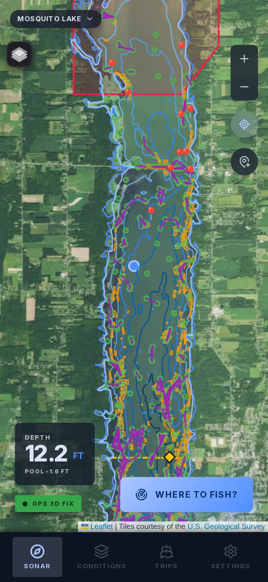
How it works
Three inputs, one spot you can run to.
01
Real bathymetry, not guesses
Every recommendation is checked against the lake's actual depth data. Humps, channels, and break lines are detected from real soundings, not a generic map.
02
Reads today's conditions
Weather, wind, water temperature, lake level, and solar position all factor into where fish are holding right now, not where they were yesterday.
03
Learns from your trips
Report what worked and LakeSense adjusts for you. Only your own history shapes your recommendations.
Where the data comes from
Public agency data, verified before it ships.
No lake goes live until its source data passes our checks. Every lake clears a ten-check acceptance gate before it appears in the app.
- Bathymetry coverage — soundings or contours cover the fishable basin
- Structure quality — detected humps, channels and breaks hold up against the survey data
- Research depth — species, seasons and regulations confirmed for the lake
- Live smoke test — a real recommendation is generated and checked end to end
Depth
Ohio Department of Natural Resources
Point soundings and contour lines published by ODNR Division of Wildlife, processed into structure layers per lake.
Base map
U.S. Geological Survey
Aerial imagery tiles courtesy of USGS, so shorelines and landmarks match what you see from the boat.
Conditions
Live weather, lake level and solar position
Wind, air and water temperature, lake level and sun angle are pulled fresh for every recommendation.
Live now in Ohio
Four lakes, verified.
Buckeye Lake
Fairfield / Licking / Perry, OH
Depth from ODNR point soundings
Delaware Lake
Delaware County, OH
Depth from ODNR point soundings
Mosquito Lake
Trumbull County, OH
Depth from ODNR point soundings
West Branch Reservoir
Portage County, OH
Depth from ODNR contour lines
More lakes come online through an automated onboarding pipeline. Each one has to pass the ten-check acceptance gate above before it ships.
Your data
Your trips stay yours.
Your trip history never trains anyone else's recommendations, and other anglers' data never touches yours. Spots you find are not shared, pooled, or sold.
Per-angler model
Adjustments from your reports apply to your account only.
No crowd-sourcing
Recommendations come from lake data and conditions, not other users' catches.
Location, narrowly
Your position is used to place you on the map and rank spots near you. It is never shared or used to build a profile.
Never sold
Your trips, spots and reports are never sold or handed to advertisers.
Pricing
Start free. Upgrade when you're on the water more.
LakeSense works today in your mobile browser. iOS and Android apps are coming soon.